Sunday, December 10, 2017


 On the Road Again
I tried to read the original On the Road, a few years back, but found it tedious.  Perhaps I’ve aged out of it; perhaps I should have read it when I blitzed through Ayn Rand, Herman Hesse, and Tom Robbins, none of which interest me at all these days.  Blue Highways, Hitchhiker’s Guide to the Galaxy and Zen and the Art of Motorcycle Maintenance are still eminently enjoyable.
First night out of Columbia, Tobey and I spent in  Jackson, Mississippi.  Yes, it broke my 500 mile limit by 100 miles, but there’s that driving into the sunset thing.  Moreover, when I reached 500 miles, I wasn’t tired, so……..
I’d called from the 500 mile mark and made a reservation forLaFleur's Bluff State Park,  an odd little place that must have once been out in the country, but is now more or less tucked into a suburb of  Jackson.  Think Sesquicentennial State Park in Columbia.  In the ‘60s, Mother and Daddy would pack a picnic, turn off the water, stop the mail….not really, but back in the day, it was a trek from our house.  Today, it’s on a crowded four lane thoroughfare.
LaFleur, like Sesqui, sits on a small lake, and my spot was lakeside. 
Dawn


 Of course, dawn was around 7:30....
Dawn


 And being right next to the lake was a treat.  “Big blue” (aka great blue heron) was out fishing and flying and making guttural big blue noises.  Two large white birds, at least as big blue, flew around.  Unlike big blue, their necks were long and curvy as they flew.  Not sure of identification, though I’m leaning toward swans.
I met a very nice couple from Winnipeg, and we exchanged itineraries, looked at maps, and raved about the joys of retirement.  Mother had made me several egg salad sandwiches, two of which I’d had for breakfast, so I finished them off, accompanied by potato chips and a glass of wine.  Devine!!! 
I didn’t unhook, so next morning, Tobey and I jumped in the car and headed out.  Here’s the advantage of the extra 100 miles:  Skipping through Dallas on a Sunday!  Had I not done that 100 miles, I would have ended up camping between Dallas and Fort Worth….and dealing with harried Monday morning commuters.  An uneventful drive brought us to Abilene, where we bedded down in a KOA.  But before I tell you about that, I must say something about the west Texas oil patch:  it’s bustling.
It's fake, but so many genuine rigs are pumping
 Tanker trucks, semis, trucks bloated with strange looking machinery, big trucks, little trucks,  pickup trucks going in tandem stuffed with sturdy four wheelers , pickup trucks driven by men looking like what I imagine a roustabout to look like:  grizzled, smoking, matted hair under a gimme cap.   West Texas is pumping oil, building pipelines, open for business.  The land itself is tired and sad, litter everywhere.


 As some of ya’ll know, I can talk to a stump (or I can be glacially off-putting….but that’s not part of this story).  I chatted with the clerk at the KOA, who turned out to be the manager of three months.  He’d been doing the KOA circuit.  Do you know there’s a KOA circuit?  Folks may work in the winter in Florida, then move up to Minnesota for the summer.  This young man had been at Mt. Rushmore (very overrated as far as I’m concerned), and heard about this managerial job in Abilene.  We talked about the adjustment and chitchatted as he checked me in.  I was paying for a back in site (they’re cheaper), and told him I was terrible at backing in, so pick one that would make it easiest for me.  I told him that other campers would come out to watch, and get their day’s entertainment by watching my pitiful attempts to back in.  I always manage, but it requires numerous tries, and the camper is never straight.  Sweet young man that he is, he gave me  a pull through site, while only charging for a back in.  Then he laughed and said his manager would probably say something about it to him the next day.  Of course, he is the manager.  

Unlike Lafleur's Bluff, this site was a tad more urban, though I'd much rather stay in my cozy camper than in the Motel 6.  At least in my camper, I know the status of my bedding!!


After two six hundred mile days (600 + 600 = 1200), I didn’t have far to go (comparatively) to reach my destination, so I treated myself to a leisurely breakfast at IHOP, and then hit the road once again.

Friday, December 1, 2017


Runnin' the road once more!!  Departing Columbia around 6ish in the AM, on Saturday, Dec 2.,  wending my way to I-20, where I will be for the next three days, until I am once again at Davis Mountain State Park in far southwest Texas.  I've been there before; it's wonderful for bird-watching.

Saturday will find me, I hope, at Frog Level Campground, in Philadelphia, Mississippi. (Yes, I could have used MS, but typing out Mississippi is just fun!)  Night #2 will be somewhere around Dallas...unfortunately.

But 500 miles (https://www.youtube.com/watch?v=ADN1lLEp3H0) is about my limit, and that puts me pretty much in downtown Dallas.

If I don't set a mileage limit, especially when driving west, I drive until I drop.  As long as there's a glimmer of light in the western sky....I drive.  Very foolish.  So I established the 500 mile cap.

As long as the campground is safe, it doesn't have to be fancy.  All I do is pull in, pop up the camper, walk the little canine, and curl up in bed for the night.  And this time, I have new flannel sheets and a new fleecy electric blanket.  I'm not sure whether I've gone up or down since the first time I backpacked....with an old boy scout pack....painful.  I confess, though, that keeping warm is now a priority.

I wake up, put down the camper, and drive on for another https://www.youtube.com/watch?v=ADN1lLEp3H0.

When I reach Davis Mountain, I will unpack and relax....and write some more.
 

Sunday, December 4, 2016

Runnin' the Road

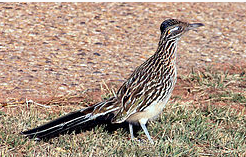
The Roadrunner should be my totem...my logo... as I "run the road" as we say in my family.  As I've said before, I come naturally by my wanderlust.  My paternal grandmother would automatically get in the car whenever the door was open.  And my maternal great grandmother would walk to town....5 miles or so....pretty much up until the day she died.  So I've been wandering around here in Arizona on my three day weekends.  Haven't done anything particularly exciting or seen anything worthy of the National Geographic.  I wander simply because....  


As of 2010, the population of Young, Arizona, was 666.  According to the website:  There are no strangers in Young, only welcomed guests.  As you travel through town, prepare to be greeted often by a pleasant wave and a friendly smile.   And it had played a role in the Pleasant Valley War, a cattleman/sheep herder range war, with a bit of bigotry thrown in range war.  
 
Pretty funky place, I gathered.  So after a good cup of my own coffee, I threw the dogs in the car (or rather, they saw the open car door and the devil himself couldn't have kept them out--kinda like me) and set off on State Route 288 for the 50 + mile jaunt.  I knew that some of the road was not paved but no concern.

And it was indeed a beautiful trip, from the desert to the ponderosa pine forest and the snow.
And as you can see, the paving had disappeared by this point.  However, it wasn't too bad, not nearly as bad as the Chaco washboard was 40 years ago.  And my little Subaru Outback was born to this kind of road. 
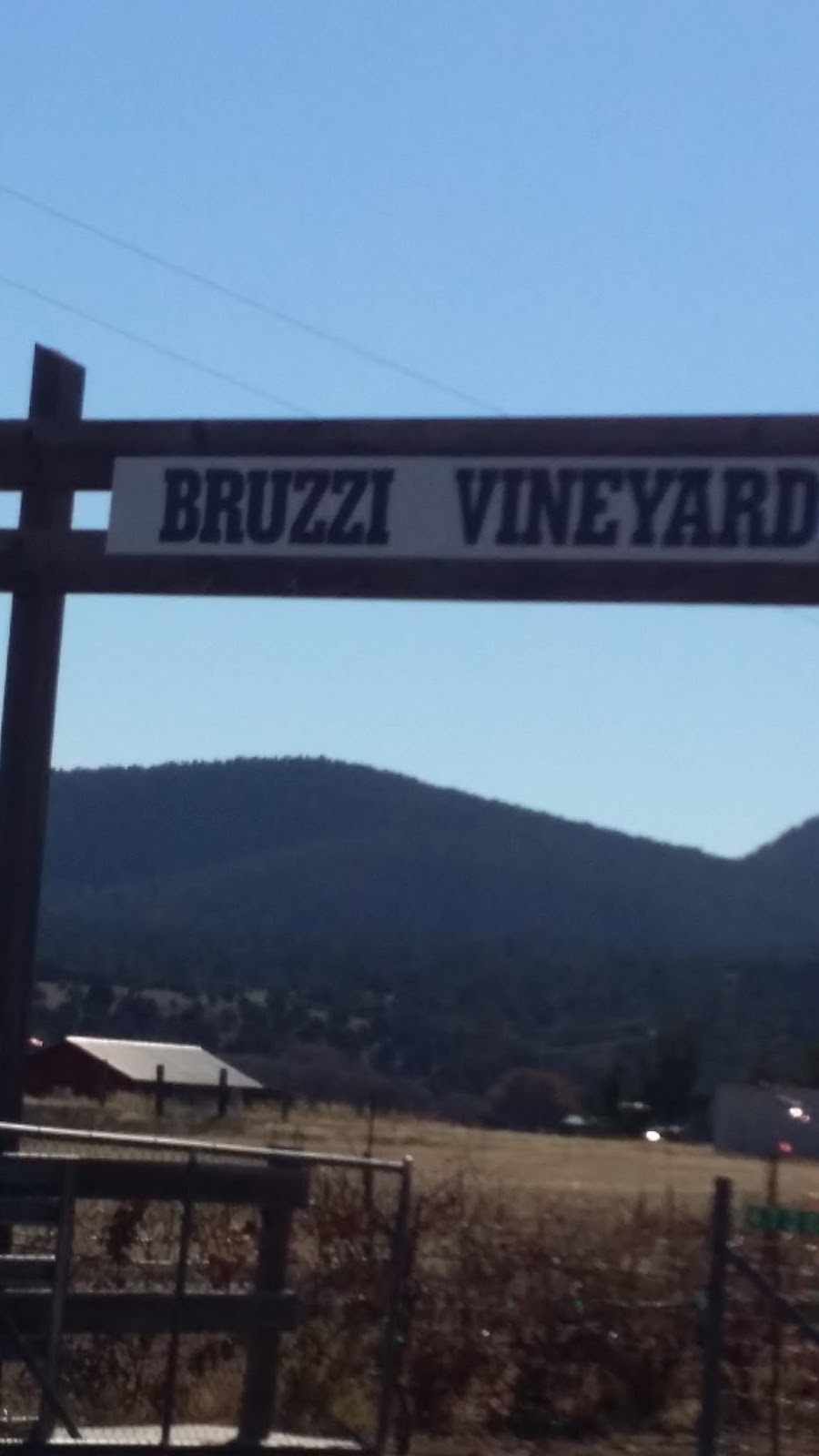
After a road trip of 50 or so miles and about 2 hours of on and off again road, I was looking forward to poking around in a funky little town, so it was with some eagerness that I spotted the sign.  Saw a few houses....rental cabins....a bar....a few churches...a cemetery.... and 

a rather chilly looking vineyard....the vines, not the people, as I had yet to see a human being.  Then...


Young is a wonderful place to photograph derelict buildings....but otherwise, not too much there there.

Sunday, November 27, 2016

A Day in the Life of a V.I.P...That's Me!


We'll skip the dog walking, coffee, and ablutions and go straight into my day as a volunteer at a National Park.

At the entrance.

The Tonto Visitor Center tucks gently into the curve of the hill.  On the second story terrace is a screen where visitors can view an 18 minute video about the Salado Indians who lived here.

Just to the right of center is my destination.
Part of the 1/2 mile trail.

I'm getting closer.

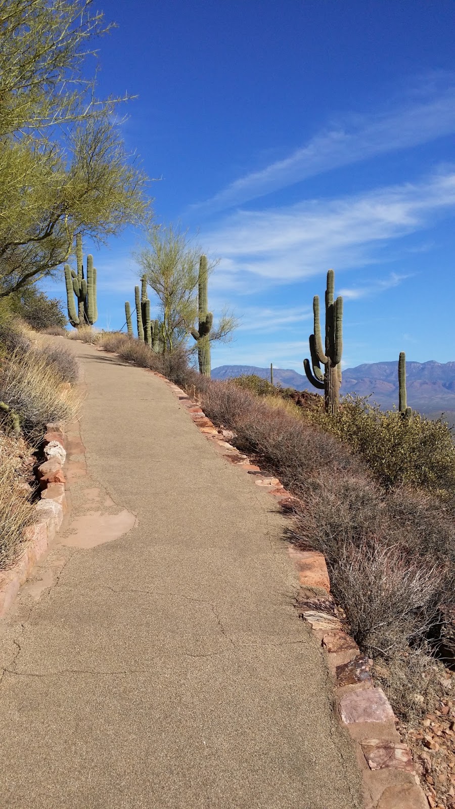
The trail is paved, in large part because it is easier and cheaper to maintain than rocks/sand/soil would be.  And the pavement makes it easier for visitors to reach the cliff dwelling.  One day last week, during my shift, I was radioed that a "party of 19" was on its way up!  Grandparents, their three children, and upteen grandchildren.  One was a toddler in a stroller, and another was a young boy with a broken leg, in a small wheelchair.

 Remember those diamond shaped, orange signs by the side of the road which warn of "6%  grade ahead.  Check brakes.  Update your will.  Call your loved ones."  The trail to the Lower Cliff Dwelling is about a 6% grade.  I carry with me what other folks refer to as a hiking stick.  For me, it is a "contemplation stick" as I drape myself over it whenever I stop to contemplate the beauty of my surroundings....which I do frequently.  After all, add a 7 to the 6 in 6% grade and you've got my age.  No comments on my IQ, please.
Confession:  I did not take this photo nor the one below; I "found" them.  The cliff dwelling at one time was 20 rooms, with construction starting around 1300 CE.  The back part of the dwelling, protected by the cliff, has fared better than the front, which was more exposed to the elements.

 
The water source is 1/2 mile below, near what is now the Monument parking lot.  It's a spring which comes from an underground aquifer.  The spring is still the source of water for the Monument and our housing area.  Women may have carried the water in pots on their heads.  I have no comment.  


Here I am in uniform, in my office.  Mother says I look stern, perhaps because it is my very first "selfie."  I greet people by saying, "Hi, Keep Your Hands off the 700 Year Old Walls" so I guess stern is good....although I attempt "stern with smile."  My job is to keep folks off the structure, answer any questions they might have, and when they want me to, give them information on the cliff dwelling and the people who built it.   Three hours a day, four days  a week, I get to hang out several hundred feet above the valley below.  Not  a bad place to have an office.

Sunday, November 20, 2016

A one photo blog post....with lotsa text!

Looks a bit pitiful, doesn't it.  A baby stroller, a blanket over what appears to be a body.  What might it be?  Some of you may be able to guess.  Here's some clues.

Casa Grande National Monument (https://www.nps.gov/cagr/index.htm), about an hour and a half from here, was having a native arts/crafts festival.  I decided to go, and Amber, a Tonto archaeologist went with me.  At least a 3 hour round trip, plus time to peruse the festival....  Got it, now??

Yes, the canines.  And why are they so concealed?  I had intended to leave them in the car, with the A/C running, as they were specifically not invited to the festival.  However, when we arrived, we learned that there was no parking at the Monument.  Rather, parking was available at a nearby strip mall, and shuttles would take us to the Monument.  Hmmmm.  Plan B.  Another Tonto volunteer loaned me the stroller, which she uses for her dogs.  I poured Tobey into one Sherpa bag, and Abbey into another; unfortunately, they will not share. Actually, I didn't have to force them in; they go voluntarily, quite eagerly, in fact.  Then I stacked them in the stroller, pulled down the sun bonnet part, covered the whole thing with a blanket. 

However!!!   When one of the shuttle overseers saw the stroller, she assumed....baby....and told me that when I got on, the driver would latch down the stroller.  Amber was looking a tad askance, for which I cannot blame her.  I told her to ignore me, drop back, and don't sit next to me.  I might need her to post bail..  I'd decided that in for a penny in for a pound or some such equally nonsensical adage.  I'd go for it!  The overseer pulled me out of line and put me on first.  Amber wisely hung back.  After the little bus was full, the driver latched the stroller front wheels onto the floor....and off we went.  The canines cooperated beautifully.  Not a peep out of either one.  I participated in a very pleasant discussion with my seatmate, a Viet Nam vet, until we arrived after a very short drive.  I was the last one off.

For the next hour and a half, I strolled around, looking at each stall, buying a few things, the dogs not making a sound.  At one point, an employee of the Monument asked me if there was something in the stroller.  I replied, "Yes, there is something."  and swept on by.  It finally occurred to me that if anyone thought any thing at all, they assumed I was the grandmother and Amber was my daughter, and I was just strolling the grandbaby.

Upon our return to the car, I decided not to push my luck and we walked back. It was about half a mile, slightly uphill, with a headwind.  Still not a peep from the canines.

That's my story, and I'm sticking with it!


Sunday, November 13, 2016

The Gate O' Doom to the UCD

(Caveat:  Text and photos were arranged by a squirrel.) 

It appears innocuous enough, does the Gate O' Doom.


And our first stop, at the covered area in the near distance, is innocent enough.

      
Eric is the Ranger for whom I was the "sweep."  He's very nice, very knowledgeable, and has very long legs!!!!  This is just past the Gate O' Doom.  We gathered together in final benediction......ooopppsss......  We rendezvoused, awaiting a few late comers, and then Eric provided an overview of the hike and went over safety procedures.  From this comfy little overhang, we could not see our goal, around the hill and up the draw, but here it is:

Majestically named:  The Upper Cliff Dwelling!  And here I have a beef with the nomenclature.  UCD.  LCD.  Sound like diseases.  Or worse, political parties.  And nearby we have Schoolhouse and Point of Pines and Casa Malpais and Besh-Be-Gowa.  And Tonto has.......UCD and LCD.  Pitiful.   However, here we go......up and up and up.
 Doesn't look so bad, does it?!?!?!?  

 It's a mere 1 1/2 miles up...and up...and up, with a rise of about 600 feet, including switchbacks 


 By the time we arrived at the switchbacks, I was so far behind the hikers I was supposed to be looking after, that Eric needed binoculars to see me...... Well, not quite, but it got embarrassing when one of our hikers pretended to take photos so he could hold back and keep an eye on me.  Oh, and he said he had a bad knee.  I have excellent knees, dammit!!  But lungs....apparently not so much.

It was either quit and go back...or die, but, finally, I struggled to the top, where the group was taking a water break before entering the cliff dwelling.

Note the exuberant child.  She was well behaved, though when I saw how much energy she had left, I considered either throwing her off the edge or jumping myself.  However, I had just enough energy to pull out my water bottle and glug glug glug, take a quick glance at the impressive vista --  over which I had not thrown myself...
Then trudge into the cliff dwelling where Eric has gathered the group into an intact room, which is pretty awesome, actually....the room that is, although the people in the group were pretty nice, too.

Eric is an excellent guide.  Visitors respond to his knowledge and easy going nature.  He did have to sit in the room as he's a tad too tall for the ceiling.  We wandered around for a while, reminding ourselves that the source of water for the cliff dwelling was 1 1/2 miles below us--and most likely women hauled it.  Sated with view and knowledge and water, we turned down the hill.....
Because I neither died nor quit, I'm supposed to "sweep" again.  My response.....
 

Sunday, November 6, 2016

Albuquerque to Tonto...and then some

Internet connectivity here is a bit iffy, though when my hotspot works, it's a tad better than at home.  That is part of the reason it's been a week since my last post.  The other reason is that I've been....exhausted.  The altitude is  about 1,000 feet higher than Wise. I'm at the Visitor Center (VC) by 8 am  (Stop laughing, Mother!!!!).....and turtle  up to the Lower Cliff Dwelling (LCD) a hike of 1/2 mile with a 350 foot rise, and (I'm told) a slope of greater than 10%. We refer to it as "going up the hill." Had I not been working out with the magical Kim Justice at Livewise (https://www.facebook.com/LiveWiseFitness/?fref=nf), I would be toast!

Back next time with more on my dwelling place in the housing area.

Because of the internet iffiness, I don't check for comments very often, probably once a week.

Photos are taken with my cell phone so they are mediocre.

Never let it be said that the desert is without color. 
    
My home for the next two months, with Roosevelt Lake in the background. https://www.nps.gov/tont/index.htm


Trail to the Lower Cliff Dwelling.  Steep but paved.  With thousands of visitors each year hiking an unpaved trail, it would deteriorate quickly.


View of the trail from the LCD
Parking lot from LCD


Visitor Center....Small but wonderful museum and video

 
If you look carefully, you can see the Lower Cliff Dwelling above the balcony of the Visitor Center, to the right of the little saddle.


I'm an official volunteer, complete with shirt, badges, and an NPS bill cap.  Unfortunately, volunteers don't get a Smokey the Bear hat.  Oh well......I'm still not a docent!!  Several folks back home called me a docent.  Docents are little old ladies with blue hair and sensible shoes, or they're Junior Leaguer types with perfectly frosted hair and exquisite makeup.  I'm a Volunteer-In-Park (VIP) at https://www.nps.gov/tont/index.htm 
  
Amber is an NPS archaeologist who lives in NPS housing here so cannot bring her beloved chihuahua.  Tobey benefits! 


When not vigilantly guarding me against....whatever...
Abbey lolls in the sun on the picnic table.

A volunteer pin which I've added to the patch that cousin Betsy sewed on my sew shirt.